Professional Drone Property Survey
Roof Inspections / Drone Property Survey
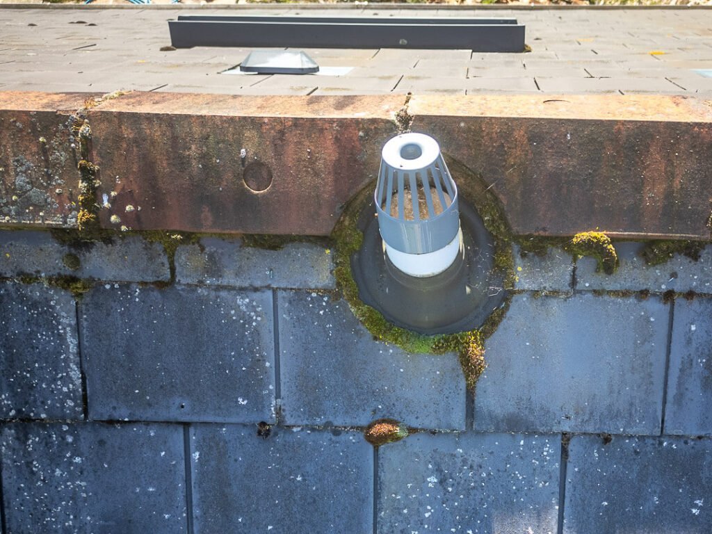
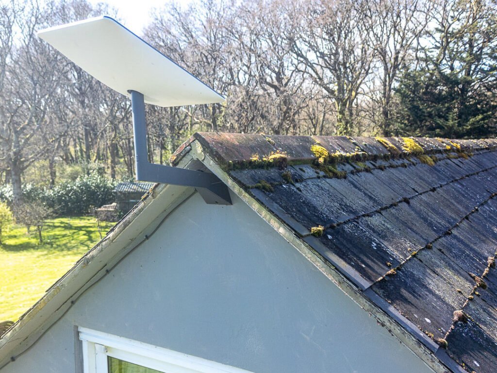
Our Drone Property Survey incorporates Comprehensive roof inspections using our state-of-the-art drones. Whether you’re a homeowner, real estate agent, or property manager, their skilled pilots can capture high-resolution images and videos of roofs. These inspections are invaluable for assessing damage, identifying maintenance needs, and ensuring safety.
Table of Contents

Use video footage to assess out-of-sight areas and get a detailed project overview. Save time and money by assessing roofs quickly and efficiently without using expensive scaffolding or towers using an aerial survey.
Quality Equipment and Professionalism
DJI drones are equipped with top-quality cameras, gyro-stabilized gimbals, and the ability to shoot HD 4K video and up to 48-megapixel still images. I am fully insured and registered with the UK Civil Aviation Authority.
With video editing software I can provide you with a detailed overview so you can assess your job. High-resolution images to show your client before quotation and carrying out building work.
How Our Professional Drone Property Survey Business Can Help You
In the rapidly evolving landscape of property management, real estate, and construction, staying ahead of the curve requires innovative solutions. Our Professional Drone Property Survey business offers a cutting-edge approach to property surveying that provides numerous benefits, ensuring you receive precise, efficient, and comprehensive service. Here’s how our services can help you:
1. Enhanced Accuracy and Detail
Traditional property surveys can be limited by human error and restricted viewpoints. Our drones are equipped with high-resolution cameras and advanced sensors, capturing every detail from multiple angles. This results in exceptionally accurate and detailed maps and models of your property, which are invaluable for planning, development, and management.
2. Time and Cost Efficiency
Time is money, especially in the fast-paced world of real estate and construction. Our drone surveys significantly reduce the time needed to conduct comprehensive property surveys. What used to take days or even weeks can now be accomplished in a matter of hours. This efficiency translates into cost savings, allowing you to allocate resources more effectively and accelerate project timelines.
3. Accessibility to Difficult Areas
Properties often have hard-to-reach or dangerous areas that are challenging for traditional survey methods. Drones can easily access these locations, capturing data without putting human surveyors at risk. This capability ensures no part of your property is overlooked, providing a complete and thorough assessment.

4. High-Quality Visual Data
The visual data collected by our drones is high in resolution using 4k. We provide detailed photographs and videos that can be used for various purposes, from marketing and sales presentations to technical assessments and legal documentation. This high-quality visual data enhances transparency and communication with stakeholders, clients, and regulatory bodies.
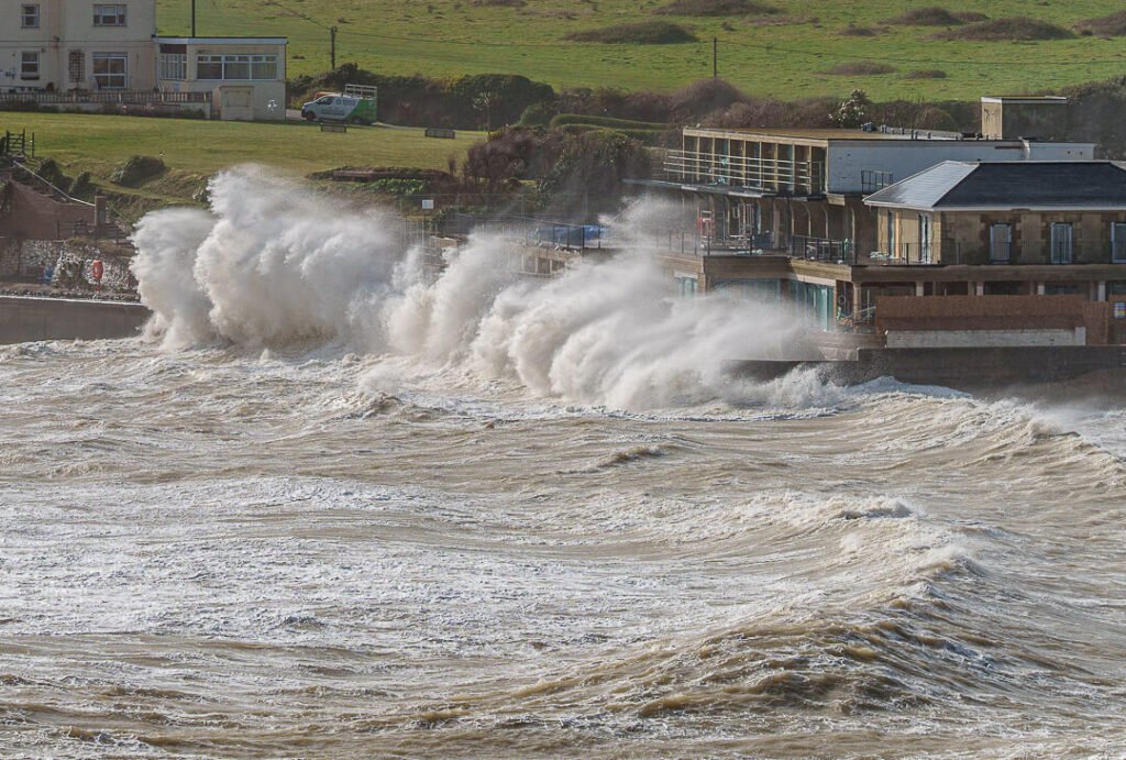
Weather and Location
Drones are more limiting than commercial aircraft we use to go on holiday. Wind and Rain are not compatible with the drones on offer today and for matters of safety will not be operated in such conditions. Our Isle of Wight Drone Photography setup will ensure that full compliance with rules and regulations is strictly adhered to.
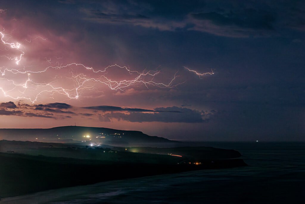
Some locations can be off-limits to drone flying and each project will be risk assessed. Other areas may be accessed with prior permission and grant of access. Please bear these restrictions in mind when deciding to embark on using aerial footage in your project or event.
If a Roof Inspection / Survey can be beneficial to your next project then please get in contact to discuss your requirements.